
Blog · Sales territories
Sales territories

Divide up your sales team's territories in minutes

Draw an area, choose how to divide it and POINOVA splits it into balanced territories. Here is how it works, step by step, with real data from several cities.

POINOVA team6 min readUpdated 2026

A retail chain grows, hires sales reps and moves into new cities. And the same old question comes up: who covers which area? Almost everyone solves it with a map and a few lines drawn by eye. The problem shows up a few months later: one rep has three times as many potential customers as a colleague, two of them overlap in the same city, and an entire district is left with no coverage.

Dividing sales territories well is not about drawing something pretty: it is about giving each person a similar workload and making sure no area is left orphaned. And that can be calculated, not guessed. We will show you how, with real examples generated in Madrid, Barcelona, Paris.

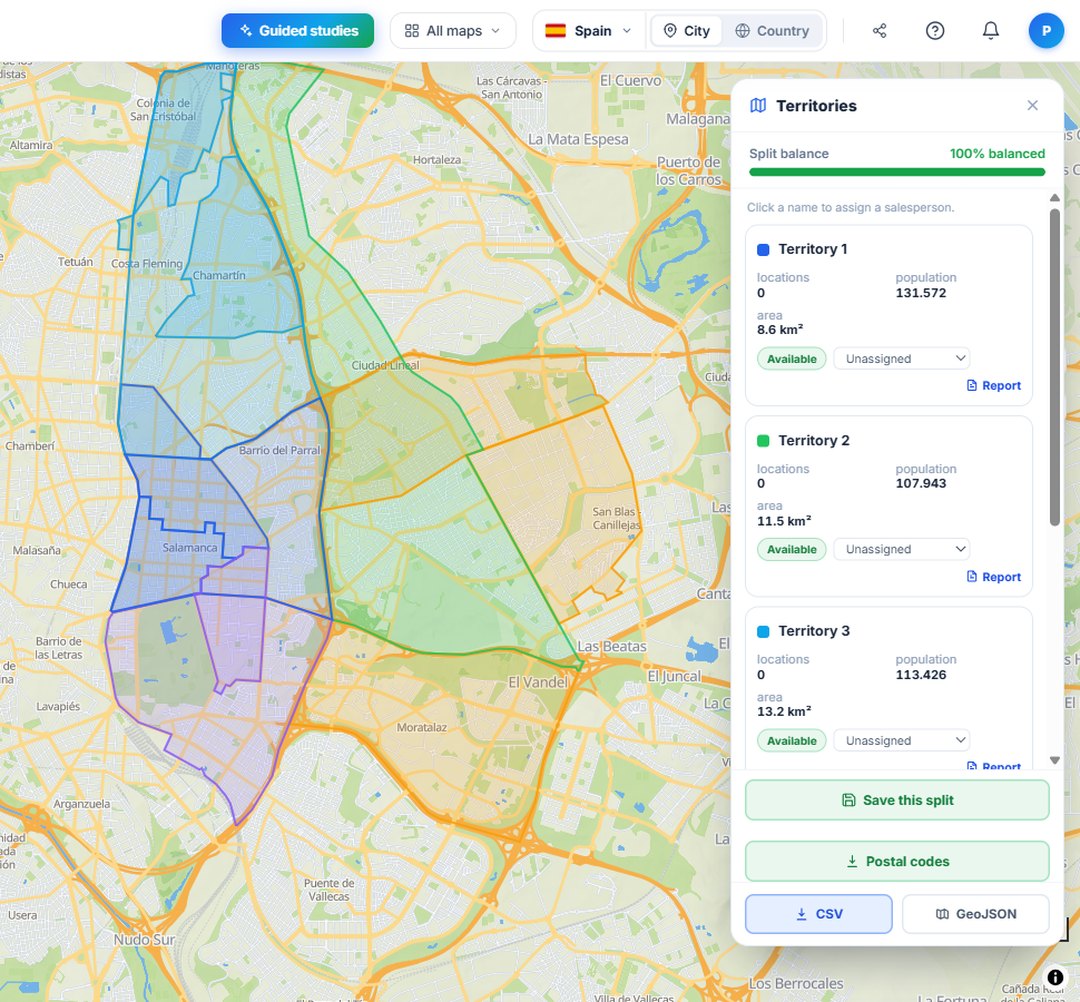
MadridBalanced sales territories split by postcode in Madrid with POINOVA
1 Draw and split

Draw the area and let it divide itself

Mark on the map the area you want to divide (a city, a province or the exact polygon you need) and choose how many territories to split it into, one per rep. POINOVA groups the postcodes that fall inside into balanced territories, without you having to draw a single line by hand.

In this example, central Madrid is split into 5 territories of similar size in a matter of seconds.

What it's for: a chain planning its expansion decides at a glance who covers each part of the city.

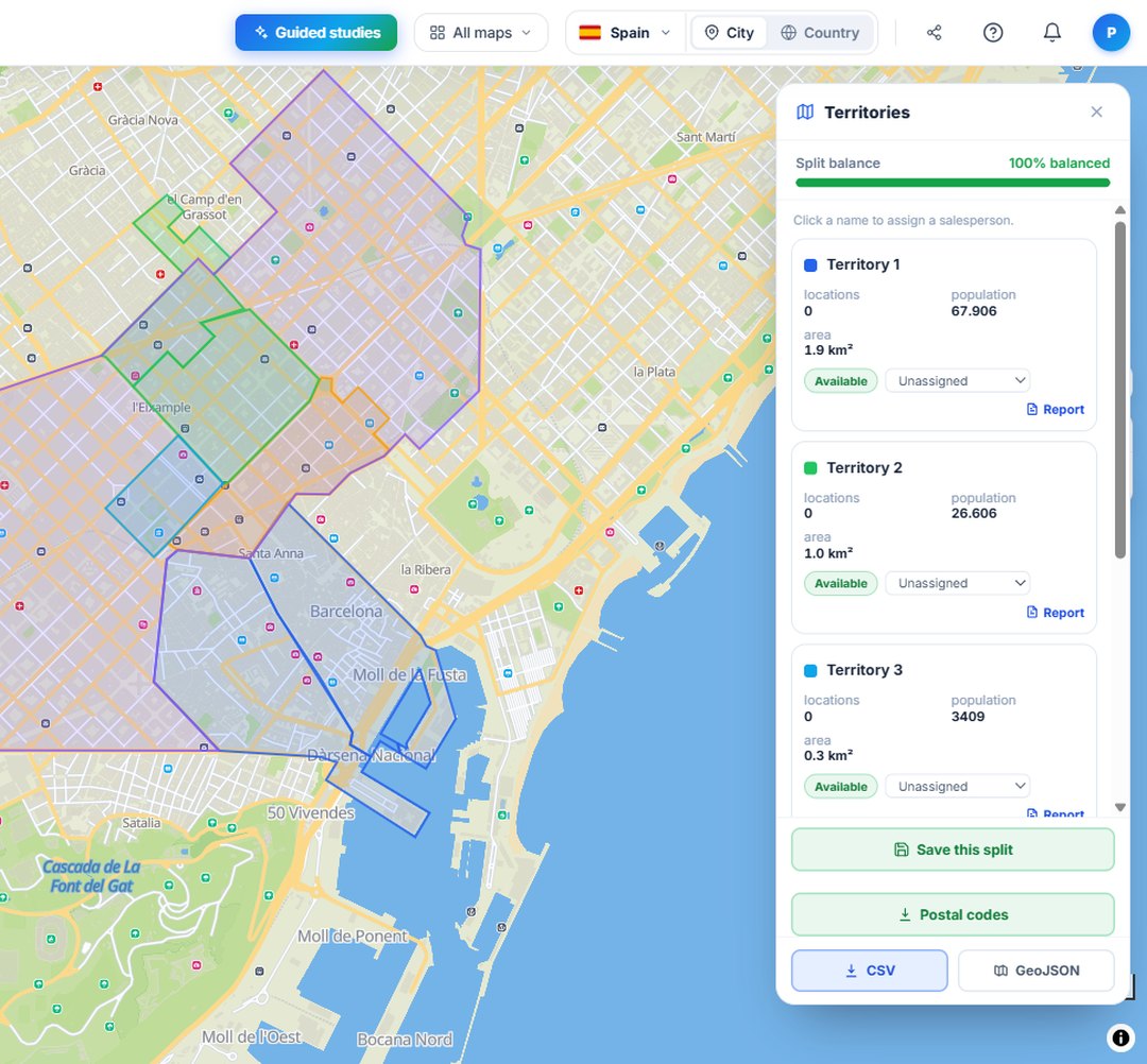
BarcelonaSales territories balanced by population in Barcelona with official data
2 Real balance

Genuinely balanced, with official data

Each territory is created with a comparable workload: a similar population, not a hunch. The panel shows you the 100% balanced split and how many people live in each area, so that commissions are fair and nobody works twice as hard for half the result.

The figures come from each country's official statistical sources, not estimates.

What it's for: dividing up targets and commissions without anyone feeling they have been landed with the worst area.

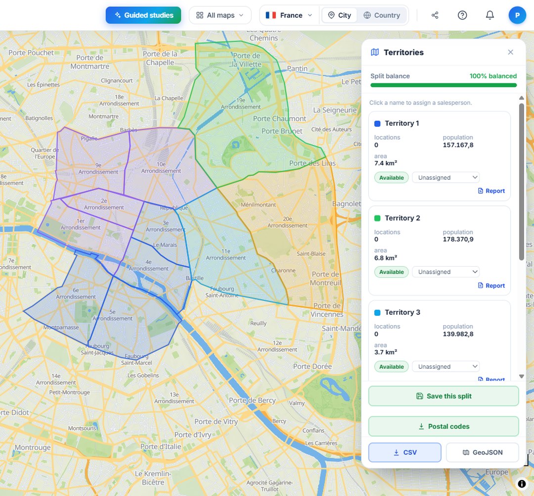
ParisSales territories by postcode in Paris, works across several countries
3 Your unit, your country

By postcode or by area, and across several countries

Divide by postcodes or by neighbourhoods, districts and sectors, depending on how your team works. And it works the same way in several countries, with the official divisions of each one, without you having to prepare anything yourself.

Here, central Paris is divided up while respecting its arrondissements and postcodes.

What it's for: a team selling in several countries uses the same tool and the same criteria across all of them.

A real use case

From an afternoon wrestling with Excel to a split ready in minutes

Picture a chain of opticians with eight sales reps spread across Madrid and Barcelona. Until now they divided the map by hand every season: arguments over who got the centre, areas nobody visited and commissions that did not add up.

With POINOVA they draw each city, split it into as many territories as they have reps and let the system balance by population. In one afternoon the map is done, each area is assigned to a person and the split is exported to the CRM. (Illustrative example; the data for each area always comes from official sources.)

100%
split balanced by population
Several countries
with each country's official data and divisions
minutes
instead of a whole afternoon

The images above are real territories generated with the tool in each city.

Try it on the territory map

Draw an area and see its population and income. No card needed.

See the territory map