Draw an area on the map and split it into balanced territories by postcode or by zones. Assign each one to your team, track its status and export it. With official population and income data.
Stop splitting your book of business by eye. Divide it using real data so every rep gets a comparable share.
Split an area into balanced territories in a couple of clicks, not whole afternoons with a map and a spreadsheet.
We balance by population so nobody ends up with an area twice the size of a teammate's.
Assign each territory to a person, mark its status and see the whole book at a glance.
Mark the area you want to split on the map: half a city, a region or several together.
By hand, by postcode or by zones. Then choose how many territories you want.
We build them balanced by population, using the units that fall inside.
Assign each territory to the team, track its status and export it to Excel.
Balanced split by postcode, computed with each country's official data. Examples generated with the tool itself.
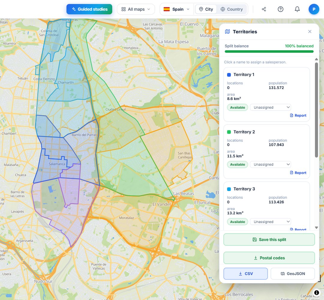
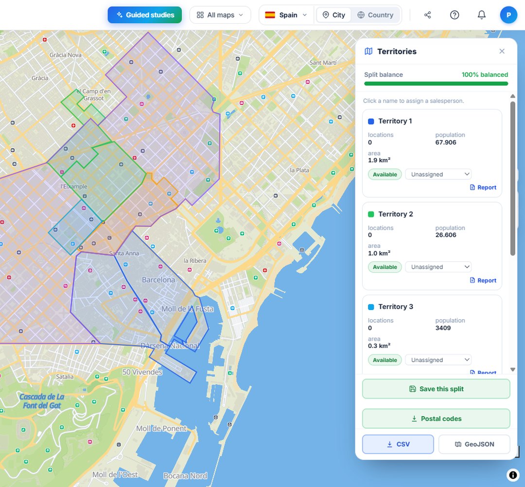
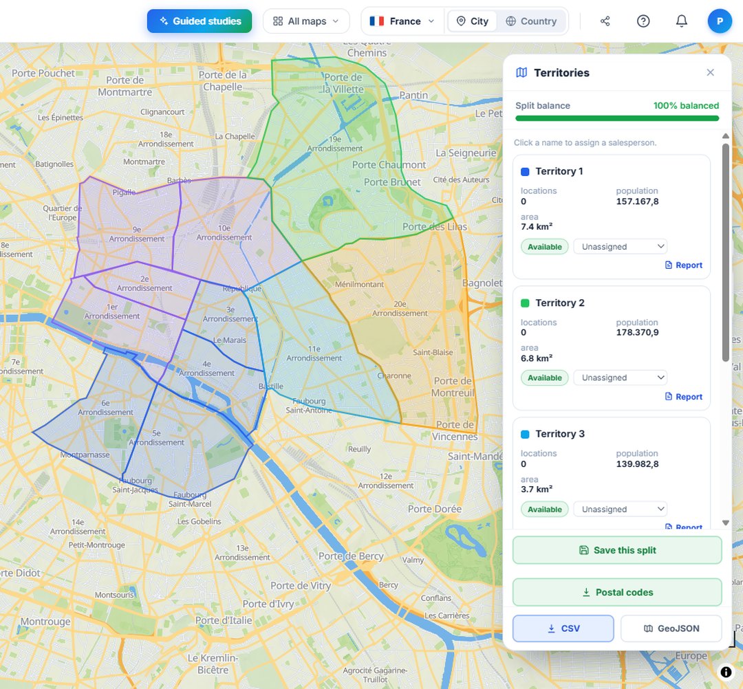
Not just cities: draw the exact polygon you need and we split what's inside it.
Split by postcodes or by neighbourhoods, districts and sectors, however your team works.
Every territory with a comparable weight, using official population and income data.
Assign each territory to a rep and always know who covers what.
Mark each territory as available, in negotiation or closed, and see how the book is progressing.
Download the split territories with their data for your CRM, your sales meeting or the contract.
Draw an area and see its population and income. No card needed.
Try for free